 |
||
| A on és troba la boia ara mateix? // Where is the buoy right now? | |||||||||||||
|
|||||||||||||
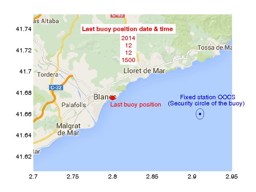
CAT: L'Observatori compta amb una boia oceanogràfica que opera la major part de l'any en una Estació d'Observació fixa a la capçelera del canyó submarí de Blanes. El mapa indica el lloc del fondeig (punt blau) i el cercle de seguretat a on ha de romandre la boia. L'última posició de la boia (en vermell) s'actualitza cada hora. En cas que la boia es trobi fora del cercle, o fins i tot fora del Port de Blanes a on es realitzen tasques de manteniment annuals, si us plau doni avís immediatament! Gràcies ! ENG: The oceanographic buoy is a component of the Observatory operating most of the year at a fixed station in the Blanes canyon head. The map shows the mooring location (blue point) and the security circle where the buoy should remain in. The map also shows the latest location (red point) of the buoy, that refreshes at hourly basis. In case you find the buoy located out of the circle, or even out of the Blanes Harbour where yearly maintenance is performed, please report immediately! Thanks ! |
|||||||||||||
| © Copyright 2009-2015 CEAB-CSIC | |||||||