|
||
Presentation
|
In 2003, the operational oceanography research group coordinated by Dr. Antonio Cruzado, participated in the project MERIS, for calibration and validation of the newly launched European environmental satellite Envisat. The group was in charge of spectral irradiance clorofilla data acquisition at the Station OOCS, at the head of the canyon of Blanes, on board the research vessel "Ixasbide". The location of the station OOCS was chosen because of its proximity to the coast (2.7 miles) and due to its location at the head of the canyon gives characteristics of offshore waters, with little influence of continental discharges. In 2005, a first trial for anchoring the oceanographic buoy at the Station was unsuccessesful. However, with the support of the OAMMS project, funded by the Ministry of Science and Innovation of Spain in 2009, the buoy was definivealy successfully installed at the station OOCS. Prior to final deployment, all instruments were sent for calibration at Seabird Elecronics in USA. Some other instruments were acquired and calibrated. Some of these instruments were tested in an interim deployment that was made in August 2009 near the coast. In September 2009, the definitivy deployment of the oceanographic buoy took place. |
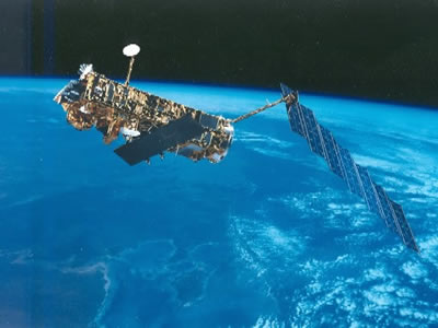
The European environmental satellite (ENVISAT) in orbit. Currently, the buoy with all the instrumentation is operational in the site at the head of the Blanes Canyon. The research boat "Dolores" which replaced the "Itaxbide" has enabled the buoy maintenance and has even allowed to trawl and install a number of 200 m mooring lines, in an example of optimizing resources to carry out coastal operational oceanography tasks. The fortnightly samplings that began from March 2009 continue today on board the "Dolores". |
||||

